
An Airborne Mission for Earth’s Polar Ice
NASA’s Operation IceBridge
images Earth’s polar ice in unprecedented detail to better understand
processes that connect the polar regions with the global climate system.
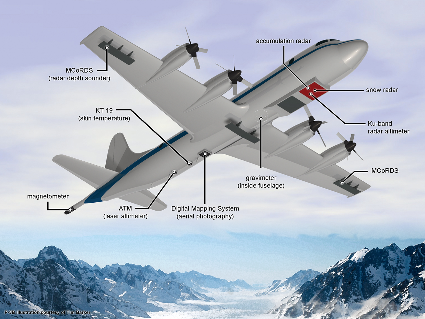
IceBridge utilizes a highly specialized fleet of research aircraft and
the most sophisticated suite of innovative science instruments ever
assembled to characterize annual changes in thickness of sea ice,
glaciers, and ice sheets. In addition, IceBridge collects critical data
used to predict the response of earth’s polar ice to climate change and
resulting sea-level rise. IceBridge also helps bridge the gap in polar
observations between NASA’s ICESat satellite missions.
Program Objectives
- Make airborne altimetry measurements over the ice sheets and sea ice to extend and improve the record of observations begun by ICESat.
- Link the measurements made by historical airborne laser altimeters, ICESat, ICESat-2, and CryoSat-2 to allow accurate comparison and production of a long-term, ice altimetry record.
- Monitor key, rapidly changing areas of ice in the Arctic and Antarctic to maintain a long term observation record.
- Provide key observational data to improve our understanding of ice dynamics, and better constrain predictive models of sea level rise and sea ice cover conditions.
- Adapt existing instruments for airborne remote sensing of ice by unmanned aerial systems such as NASA’s Global Hawk.
Science Goals
- Measure changes in Greenland and Antarctica ice sheet volume to maintain a record of data between ICESat and ICESat-2.
- Improve understanding and simulation of ice sheet flow and volume change by documenting glacier ice thickness, basal topography and other geophysical properties.
- Document changes in sea ice thickness in the Arctic and Southern Oceans.
- Improve sea ice thickness data by advancing technologies for measuring surface elevation, freeboard and snow depth.

Download Image
› Full SizeAlaskan Mountains Seen During IceBridge Transit
Alaskan mountains seen from high altitude aboard the NASA P-3B during the IceBridge transit flight from Thule to Fairbanks on March 21, 2013.NASA's Operation IceBridge is an airborne science mission to study Earth's polar ice. For more information about IceBridge, visit: www.nasa.gov/icebridge.
Image Credit: NASA/Goddard/Christy Hansen
Guillermo Gonzalo Sánchez Achutegui
ayabaca@gmail.com
ayabaca@hotmail.com
ayabaca@yahoo.com
Inscríbete en el Foro del blog y participa : A Vuelo De Un Quinde - El Foro!
No hay comentarios:
Publicar un comentario